

Land Ecosystem Atmosphere Program (LEAP) - Whroo OzFlux Flux Tower and Supersite

Investigators and Partners
This project is the product of the combined efforts of many interdisciplinary researchers of various expertise and was initiated by:
- Prof. Jason Beringer (Micrometeorology)(UWA)
- Prof. Ross Thompson (Aquatic ecologist)(ACU)
- Dr. Timothy Cavagnaro (Soil ecologist)(Uni Adelaide)
- Prof. Ralph Mac Nally (Landscape ecologist)(ACU)
- Dr. Patrick Baker (Plant biology)(The Uni Melbourne)
- Mr Mark Eigenraam (DSE)
- Mr Leon Metzeling (EPA)
Project Overview
Farming carbon via tree plantings on pasture land is becoming increasingly common to address the effects of climate change. This activity is likely to produce dramatic changes in Australia's rural landscapes, but we have little knowledge of likely effects on crucial ecosystem services and attributes such as stream water yields and biodiversity. This project investigates the relationship between tree cover, carbon uptake, water yield and biodiversity. The outcomes will allow government agencies, landowners and carbon farming groups to better evaluate the effects of different landscape planning options and contribute to effective long-term planning for multiple goals. The site was established in October 2011 as part of an ARC Linkage project "More bang for your carbon buck: carbon, biodiversity and water balance consequences of whole-catchment carbon farming" (LP0990038) Dr Ross Michael Thompson, A/Prof Jason Beringer, Dr Timothy Richard Cavagnaro, Prof Ralph Charles Mac Nally, Dr Patrick John Baker, Mr Mark Eigenraam, Mr Leon Metzeling. The tower will provide longterm measurements as part of the Ozflux network and the infrastructure is partly funded through the NCRIS TERN OzFlux and Supersite facilities.
Key research questions
The Site Location
The Whroo flux station was located approximately 45km south west of Shepparton, Victoria: 36° 40' 22.98"S, 145° 1' 34.37"E.
Site Characteristics
The flux tower site was classified as box woodland. The vegetation is dominated by two main Eucalypt species: Eucalyptus microcarpa (Grey Box) and Eucalyptus leucoxylon (Yellow Gum). Smaller numbers of Eucalyptus sideroxylon (Ironbark) and Acacia pycnantha (Golden Wattle) are also found on site. Elevation of the site is close to 165 m and mean annual precipitation from a nearby Bureau of Meteorology site measured 558 mm. Maximum temperatures ranged from 29.8°C (in January) to 12.6°C (in July), while minimum temperatures ranged from 14.2°C (in February) to 3.2°C (in July). Maximum temperatures varied on a seasonal basis by approximately 17.2°C and minimum temperatures by 11.0°C.
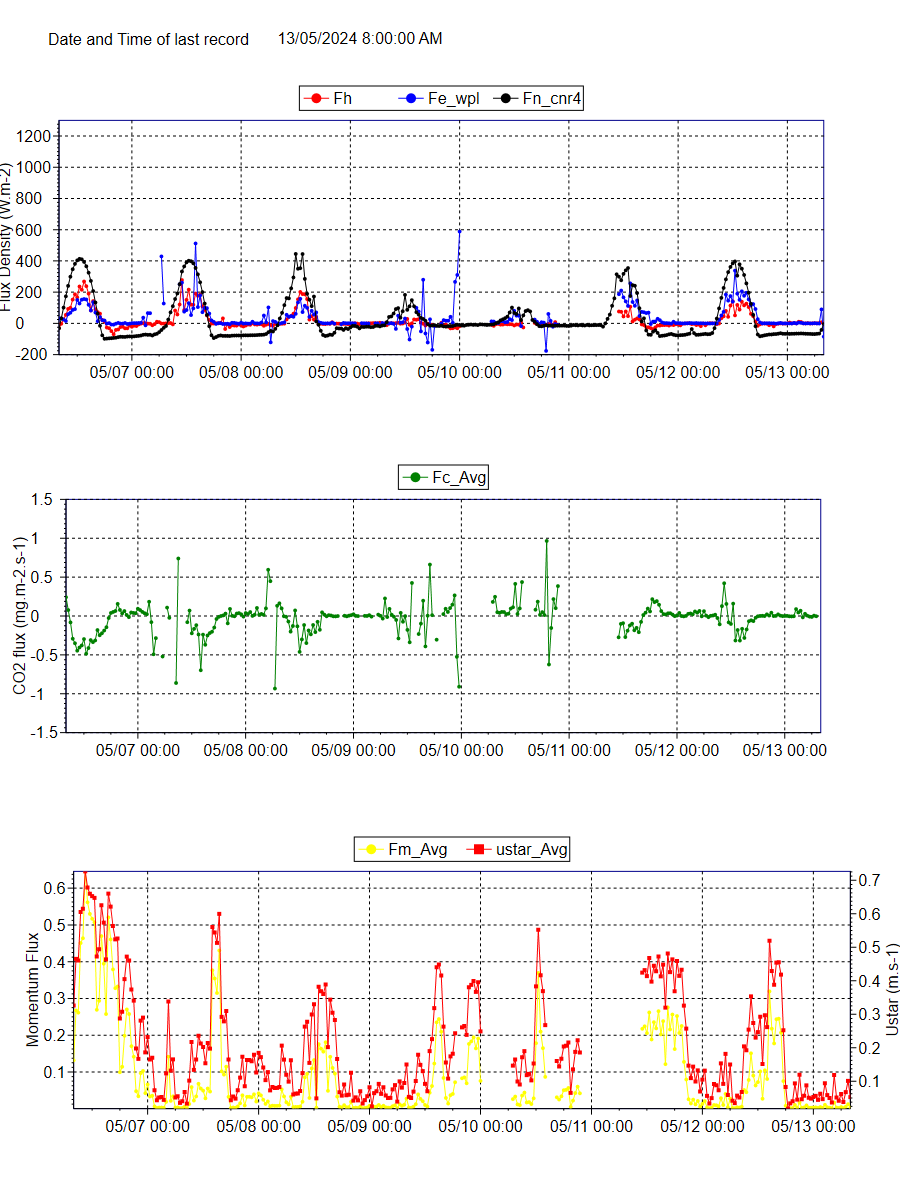
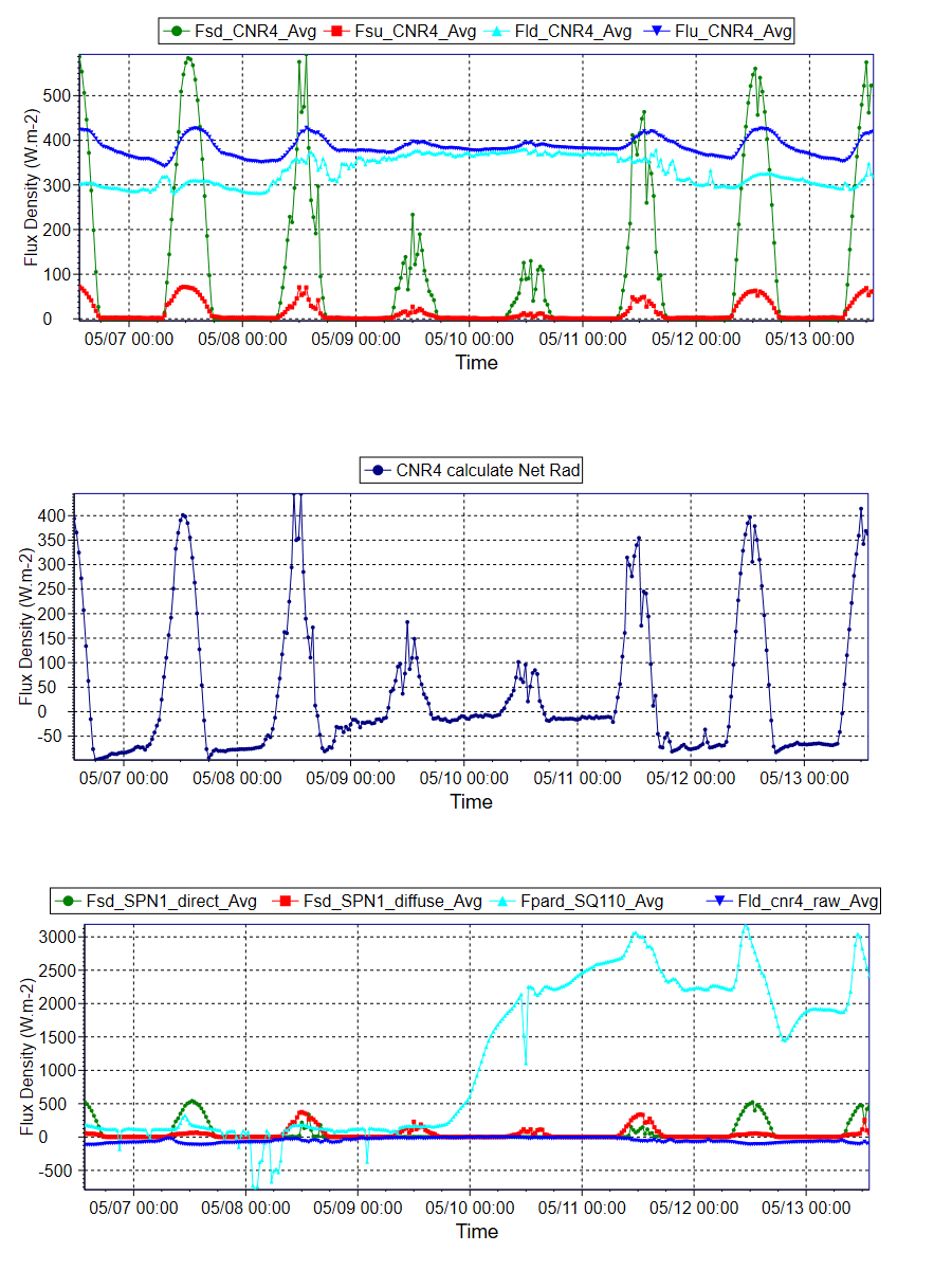
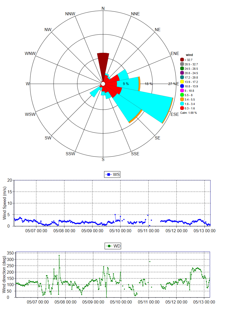
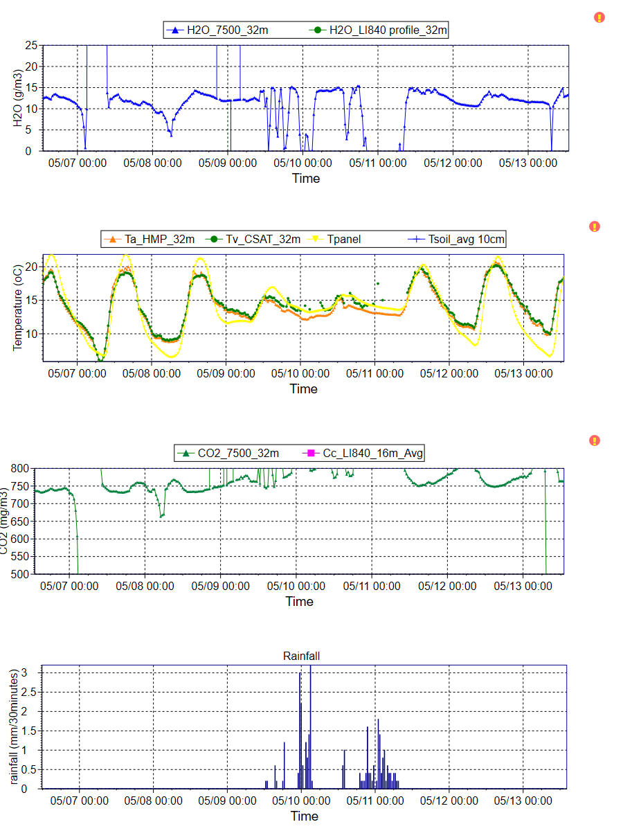
The instrument mast is 36m tall. Heat, water vapour and carbon dioxide measurements are taken using the open-path eddy flux technique. Temperature, humidity, wind speed, wind direction, rainfall, incoming and reflected shortwave radiation and net radiation were measured above the canopy. Soil heat fluxes are measured and soil moisture content is gathered using time domain reflectometry.
Data
Data from this site is available through the OzFlux data portal international FLUXNET database or via the investigators email jason.beringer[@]uwa.edu.au
Further Information
- Prof. Jason Beringer homepage
- School of Earth and Environment
- Charles Darwin University
- The Australian Flux Network (OzFlux)
- The Terrestrial Ecosystem Science Network (TERN)
- The Terrestrial Ecosystem Science Network (TERN) Supersite network
- The National Collaborative Research Infrastructure Strategy (NCRIS)
- The International FLUXNET
Acknowledgements
This site is produced by Prof. Jason Beringer, UWA, School of Earth and Environment and proudly part of the Australian Flux Network(OzFlux) and partly supported by the Australian NCRIS Terrestrial Ecosystem Research Network (TERN). Australian Research Council grants supported this work (DP0344744, LP0774812, DP0772981, LP0990038, DP130101566 and FT110100602)

| Instrument Type | Make | Model | Situation |
|---|---|---|---|
| Bidirectional pyranometer / pyrgiometer | Kipp and Zonen | CNR4 | 36m |
| Combination cup anemometer / wind vane (6 replicates) |
RM Young | 03002 | 1m, 2m, 4m, 8m, 16m, 32m |
| Infra-red gas analyser | LiCOR | LI-7500 | 36m |
| Quantum sensor | Apogee | SQ-110 | |
| Soil heat flux plate (4 replicates) |
Hukseflux | HFP01 | -0.08m |
| Soil temperature probe (4 replicates) |
Campbell Scientific | TCAV | All at -0.08m |
| Solar regulator | Prostar | PS-30M | |
| 3D Sonic anemometer | Campbell Scientific | CSAT3 | 36m |
| Temperature and Relative Humidity sensor (6 replicates) |
Campbell Scientific | HMP-45C | 1 each at 1, 2, 4, 8, 16 & 32m |
| Soil Moisture Probe (8 replicates) |
Campbell Scientific | CS-616 | 4 at -0.1m & 1 at each of -0.2, -0.4, -0.8, -1.5m |
| Unidirectional sunshine pyranometer | Delta | SPN1 | 36m |
| Logger | Campbell Scientific | CR3000 | 1.5m |
| Multiplexor | Campbell Scientific | AM25T | 1.5m |
| Rain gauge | Hydrological Services | TB3 | 36m |
| Profile gas analyser | LiCOR | LI-840 | 32m |
| Profile pressure line | Vaisala | CS105 | 16m |
| Profile air pressure | Vaisala | CS106 | 16m |
| Flow meter | Aalborg | GFM17 | 16m |
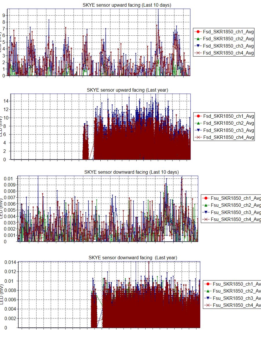
| Photosynthetically Active Radiation (PAR) sensor | Campbell Scientific | Quantum LI-190 | 2 at 36m, one facing upward, one facing downward |
| 4-channel light sensor | Skye Instruments | SKR 1850 | 2 at 36m, one facing upward, one facing downward |
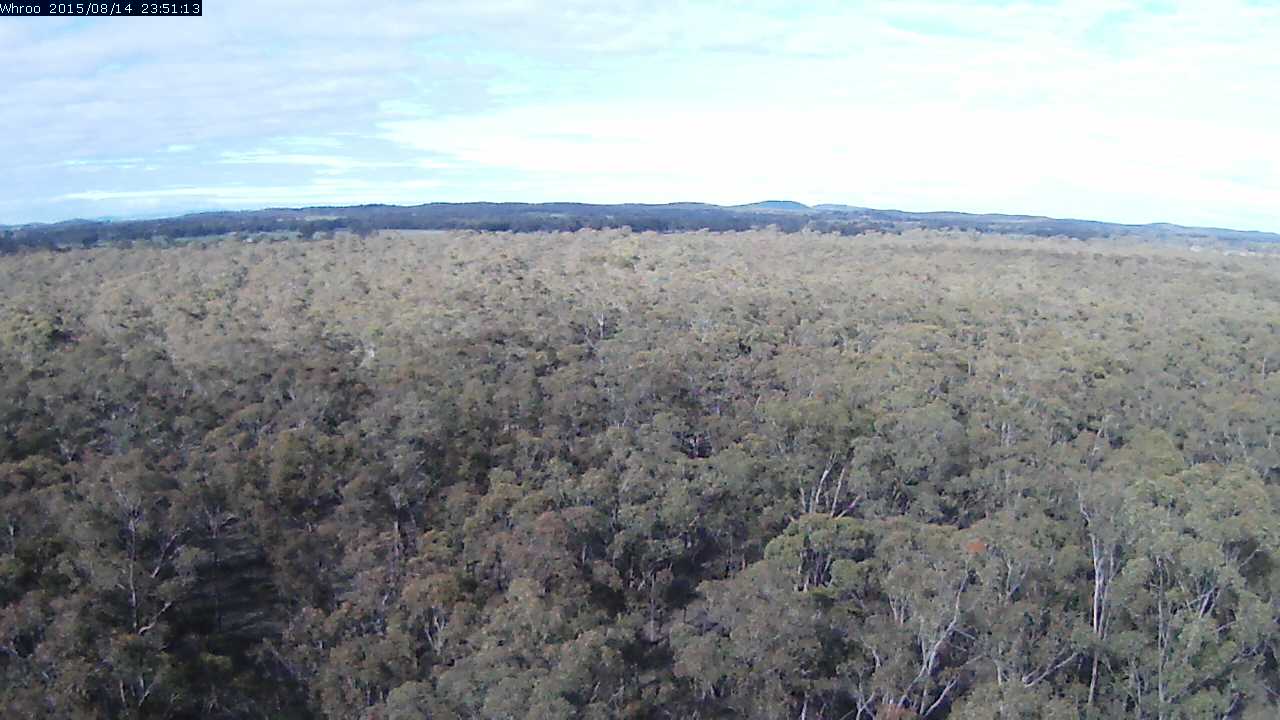
This image is taken by a Vivotek Network Camera (IP8362) and is updated every 30 minutes. The timestamp is provided in Coordinated Universal Time (UTC).
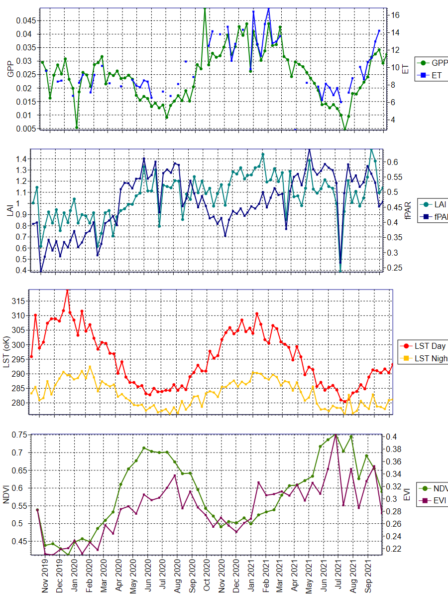
The data was obtained from the Oak Ridge National Laboratory Distributed Active Archive Center for Biogeochemical Dynamics (ORNL DAAC) (https://daac.ornl.gov/MODIS/). The ORNL DAAC provides MODIS Land Product Subsets for model validation, site characterisation and remote-sensing purposes.
Daily updated data was obtained from this provider, with an area of 3x3km extracted using Python script written by Mr. Darien Pardinas-Diaz ([email protected]). The plots were produced using QC Filter Conditions 000 and 001. Condition 000 represents the highest QC Filter possible and 001 represents a reliable and usable QC Filter, though not to the standard of 000.

University information
CRICOS Code: 00126G