

Land Ecosystem Atmosphere Program (LEAP) - Sturt Plains OzFlux Flux Tower Site

Investigators and Partners
This project is the product of the combined efforts of many interdisciplinary researchers of various expertise and is currently operated by:
- Prof Lindsay Hutley (Ecophysiologist)(CDU)
- Prof Jason Beringer (Micrometeorology)(UWA)
Project Overview
The site provides nationally consistent observations of vegetation dynamics, faunal biodiversity, micrometeorology (climate, radiation, fluxes of carbon and water), hydrology and biogeochemistry to examine the impacts of fire regime, climate on carbon stocks and GHG emissions, and impacts on habitat quality via ongoing monitoring of vegetation structure and fauna. A wide range of ground based observations of vegetation structure and floristics is planned and all will link to remote sensing of fire and vegetation change over time. Measurements of carbon sequestration through time will be achieved via the instrumentation capable of directly measuring CO2, water use and surface energy properties (energy balance, reflectance). The tower will provide longterm measurements as part of the Ozflux network and the infrastructure is partly funded through the NCRIS TERN OzFlux facilities.
Key research questions
The Site Location
The Sturt Plains flux station is located approximately 280km north of Tennant Creek, Northern Territory. It was established in August 2008 and is managed by Monash University external and Charles Darwin University. The Sturt Plains OzFlux Site is located at: Latitude: -17.1507 S Longitude: 133.3502 E
Site Characteristics
The flux tower site is 280km north of Tennant Creek, amongst a low lying plain dominated by Mitchell Grass (gen. Astrebla). Elevation of the site is close to 250m and mean annual precipitation at a nearby Bureau of Meteorology site is 640mm.
Maximum temperatures range from 28.4°C (in June/ July) to 39.1°C (in December), while minimum temperatures range from 11.2°C (in July) to 24.4°C (in December).
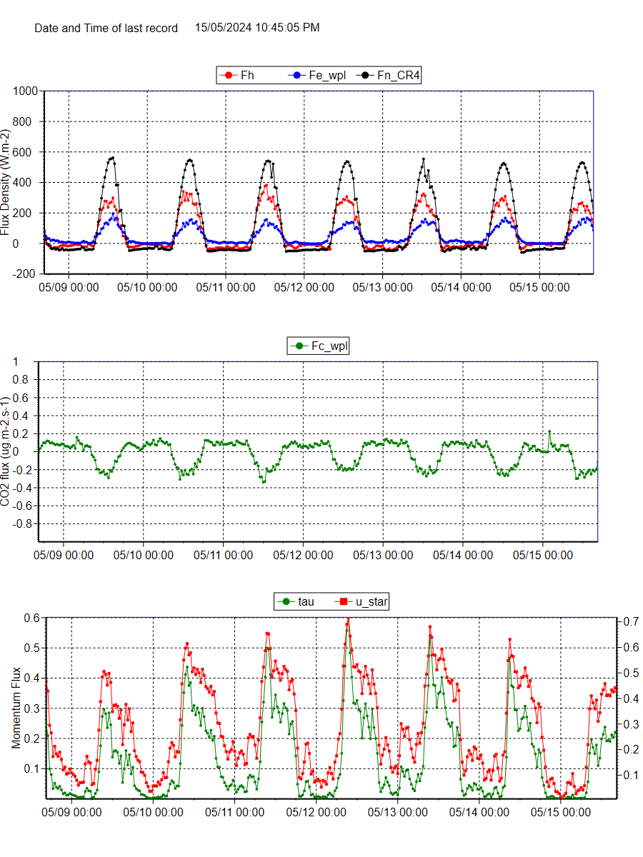
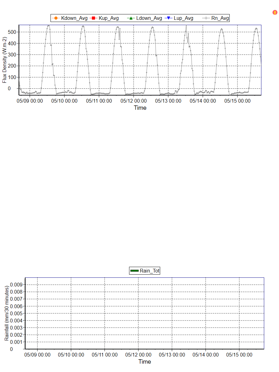
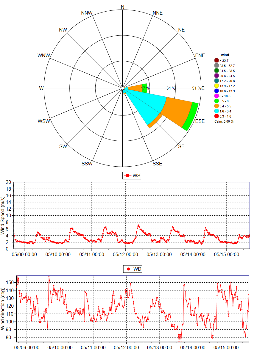
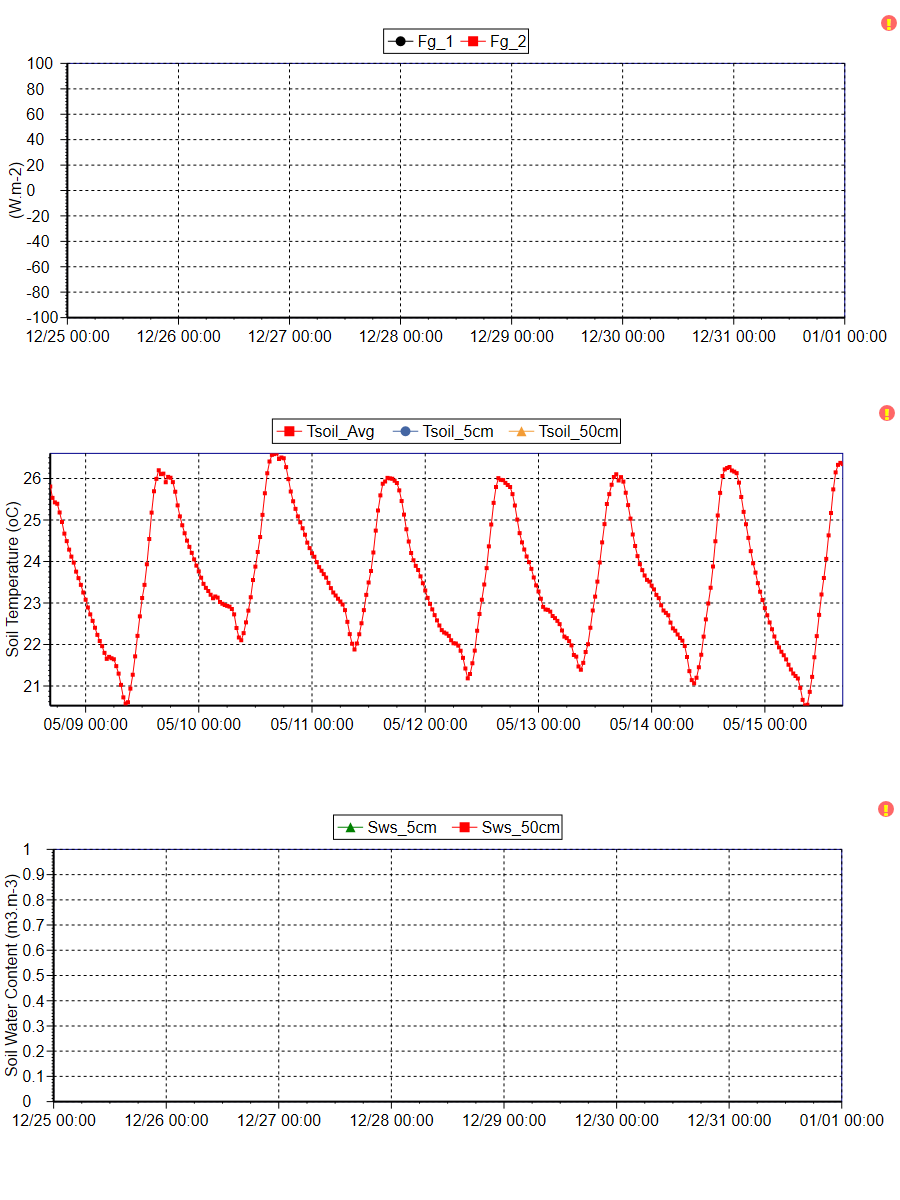
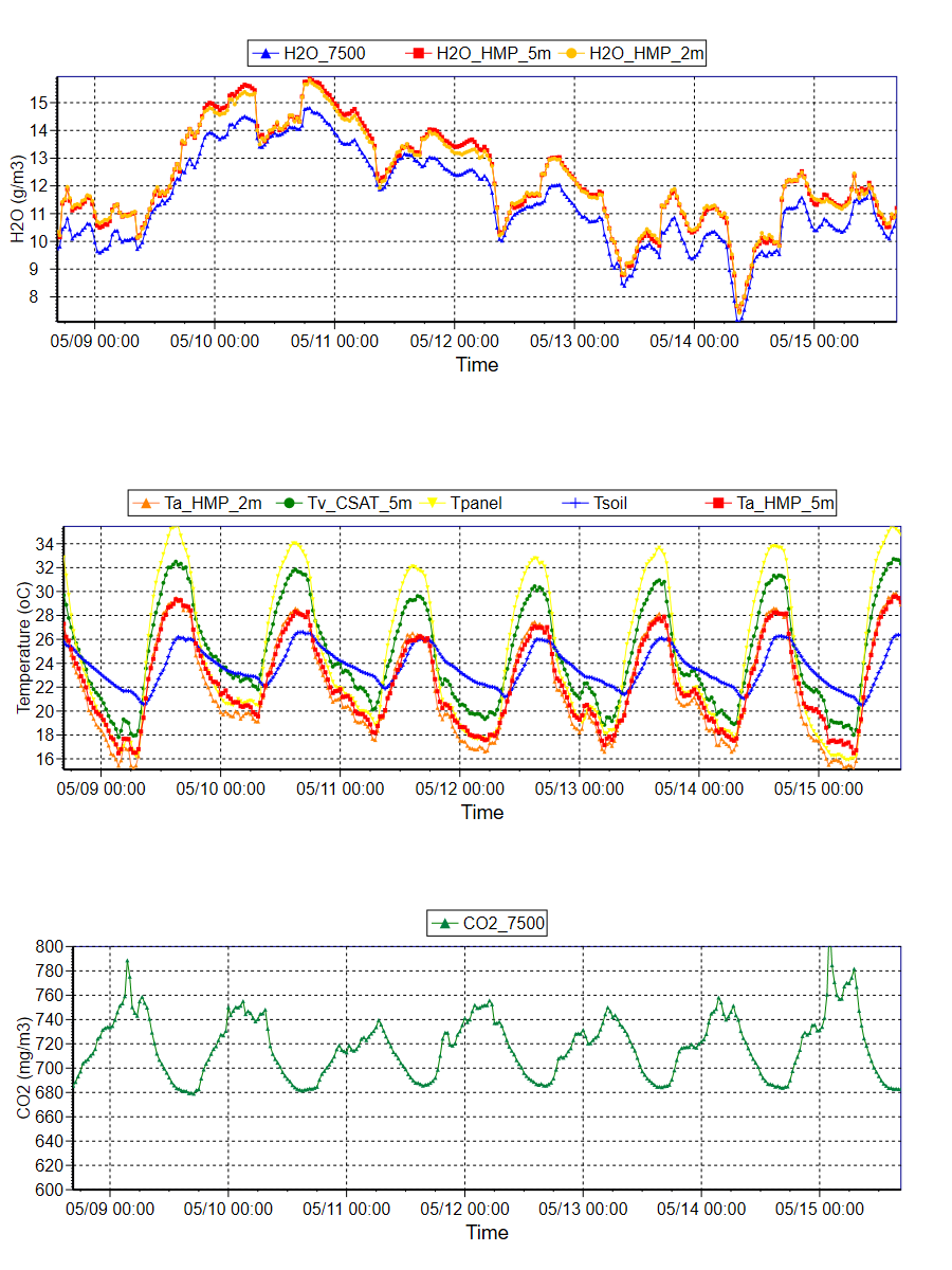
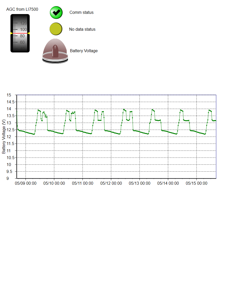
The instrument mast is 5 meters tall. Heat, water vapour and carbon dioxide measurements are taken using the open-path eddy flux technique. Temperature, humidity, wind speed, wind direction, rainfall and net radiation are measured. Soil heat fluxes are measured and soil moisture content is gathered using time domain reflectometry.
Ancillary measurements taken at the site include LAI, leaf-scale physiological properties (gas exchange, leaf isotope ratios, N and chlorophyll concentrations), vegetation optical properties and soil physical properties. Airborne based remote sensing (Lidar and hyperspectral measurements) was carried out across the transect in September 2008.
Biomass Harvest - mean live biomass: 0.00 gm-2 (standard error: 0.00) , mean standing dead biomass: 163.42 gm-2 (standard error: 16.73), mean litter biomass: 148.99 gm-2 (standard error: 21.32), total mean biomass: 312.40 gm-2 (standard error: 30.80), Soil- Clay: 14.47% (volume <1µm), Silt: 51.23% (volume <1µm), Sand: 34.30% (volume <1µm), Sand (>1 µm): 1.02% (total weight)
Data
Data from this site is available through the OzFlux data portal international FLUXNET database or via the investigators email jason.beringer[@]uwa.edu.au
Further Information
- Prof. Jason Beringer homepage
- Prof. Lindsay Hutley homepage
- School of Earth and Environment
- Charles Darwin University
- The Australian Flux Network (OzFlux)
- The Terrestrial Ecosystem Science Network (TERN)
- The Terrestrial Ecosystem Science Network (TERN) Supersite network
- The National Collaborative Research Infrastructure Strategy (NCRIS)
- The International FLUXNET
Acknowledgements
This site is produced by Prof. Jason Beringer, UWA, School of Earth and Environment and proudly part of the Australian Flux Network(OzFlux) and partly supported by the Australian NCRIS Terrestrial Ecosystem Research Network (TERN). Australian Research Council grants supported this work (DP0344744, LP0774812, DP0772981, LP0990038, DP130101566 and FT110100602)


Instrument |
Make |
Model |
Description |
Albedometer |
Kipp & Zonen |
CM7B |
4.8m |
Data logger |
Campbell Scientific |
CR3000 |
Ground |
Open Path CO2 and H2O |
LI-COR |
Li-7500 |
4.8m |
Net Radiometer |
Kipp & Zonen |
NR Lite |
4.8m |
Rain gauge |
Campbell Scientific |
CS702 |
4.8m |
Soil heat flux |
Campbell Scientific |
HFT3 |
-0.15m |
Soil moisture (two replicates) |
Campbell Scientific |
CS616 |
-0.05, -0.50m |
Sonic anemometer |
Campbell Scientific |
CSAT3 |
4.8m |
Temperature and Relative Humidity |
Vaisala |
HMP45AC |
4.8m |
Net Longwave Radiation |
Kipp & Zonen |
CG-2 |
4.8m |
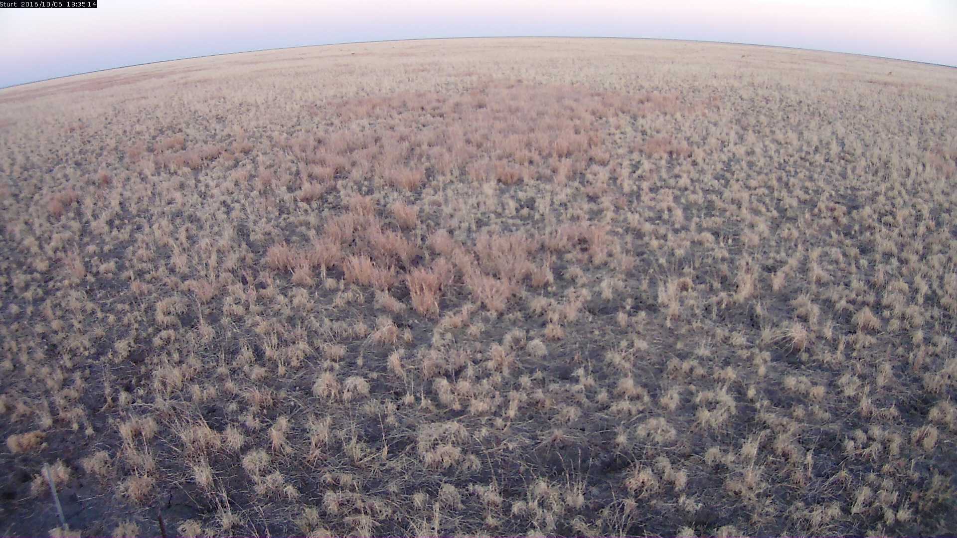
This image is taken by a Vivotek Network Camera (IP8362) and is updated every 30 minutes. The timestamp is provided in Coordinated Universal Time (UTC).
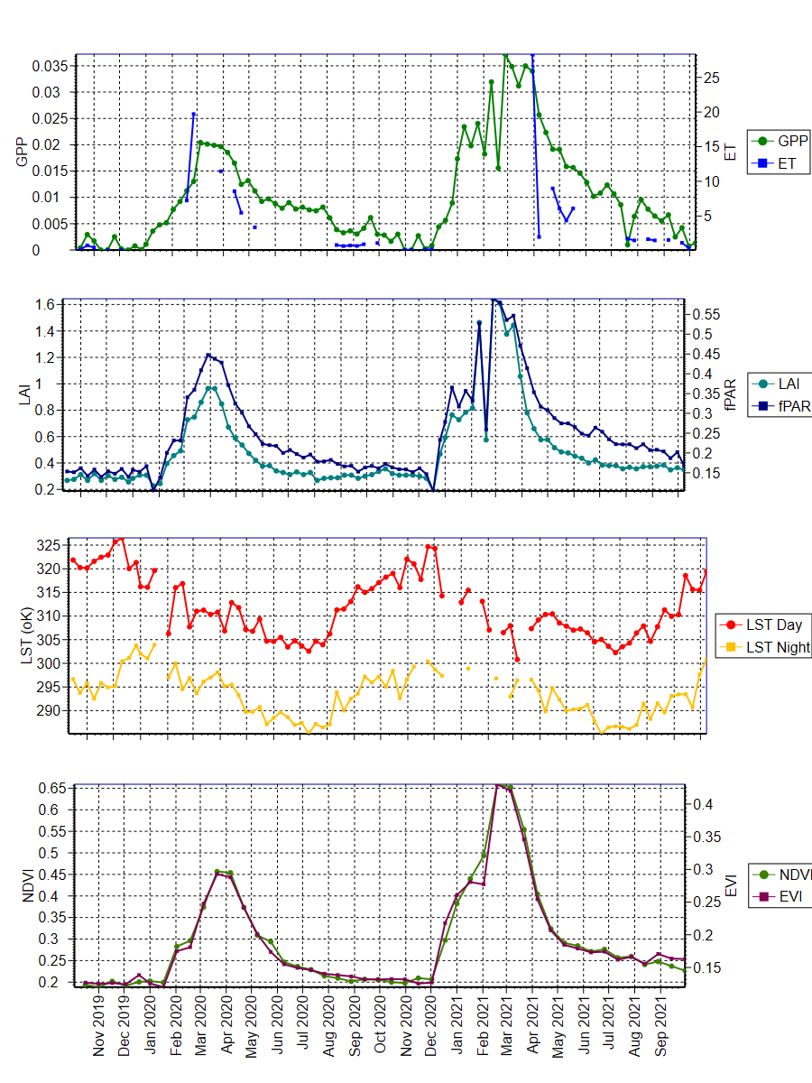
The data was obtained from the Oak Ridge National Laboratory Distributed Active Archive Center for Biogeochemical Dynamics (ORNL DAAC) (https://daac.ornl.gov/MODIS/). The ORNL DAAC provides MODIS Land Product Subsets for model validation, site characterisation and remote-sensing purposes.
Daily updated data was obtained from this provider, with an area of 3x3km extracted using Python script written by Mr. Darien Pardinas-Diaz ([email protected]). The plots were produced using QC Filter Conditions 000 and 001. Condition 000 represents the highest QC Filter possible and 001 represents a reliable and usable QC Filter, though not to the standard of 000.

University information
CRICOS Code: 00126G